While Detroit, founded in 1701, may be considered old compared to our nation, some paths in the region are older still — some by more than 1,000 years. Michigan’s indigenous peoples built these trails, which still function today — some as hiking or snowshoeing trails, others as roads, interstate highways, and more.
Archeological evidence indicates human activity in Michigan for at least the past 12,000 years. The Hopewell culture — predating the Anishinaabe people, including the Odawa (Ottawa), Ojibwe (Chippewa), and Potawatomi tribes — took root in Michigan as early as 200 B.C., if not earlier. Michigan’s early inhabitants cleared the pathways for trading, hunting, and travel. While they preferred to travel in canoes on Michigan’s waterways, inland travel was a necessity. Thankfully, they had some help conquering the rough terrain.
“They were following deer and bison. … The animals would take the path of least resistance, and it just made sense to people how to get around,” says Robert Myers, senior advisor of history programming for the Historical Society of Michigan. “Europeans thought they were nomadic, but really, they weren’t. They had summer villages and winter villages. There was a homeland area they would be living in during the summer months — fields of corn, beans, and squash — and then the village might pack up and go to Lake Michigan to do some fishing.”
Myers highlights the strong kinship among the indigenous people, yet another reason for travel. Potawatomi in southwest Michigan would trek the trails to visit family in Detroit.
The passage of large game and hunters clearly aided the process of creating the Native American trails, but they don’t account for every path. Still, nothing was random. The indigenous people had a clear sense of their direction and destination, constructing an efficient trail system throughout the state. They considered how to reach shallow points or log jams to cross rivers or streams and avoid difficult passages that may have proven too challenging for elderly tribe members or young children, among other concerns.
Some Native American trails extend from coast to coast across Michigan, with others reaching beyond today’s state lines. Michigan’s native people created the trails thousands of years ago, designing them so effectively that European settlers could hardly improve on their locations. As such, early European fur trappers utilized the trails, which later widened and straightened to serve as routes for stagecoach travel.
Leslie Pielack, author of The Saginaw Trail: From Native American Path to Woodward Avenue, explains, “When you go into a park and there is a walking path, you know it’s a footpath, but if you’re going to put a road through there, you’re going to have to widen it. You’re going to have to take down trees. … There might be an area where you make your path straight when it went one way or the other.”
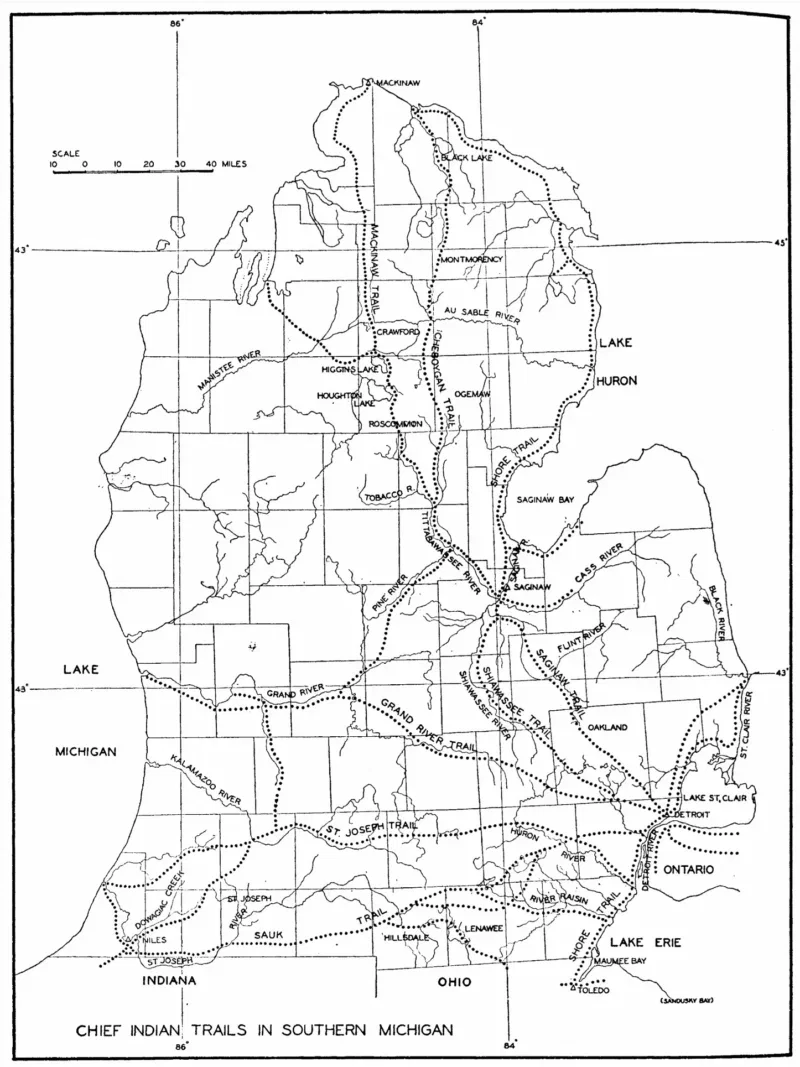
Creating the original trails may have been easier than making sense of the routes today. Doing so calls for patience and crossreferencing skills. One trail may be known by at least two names, trails are sometimes categorized as major or minor, and some split off, raising the question: Is this section still under the name of the main trail?
Frank Ettawageshik, executive director of the United Tribes of Michigan and citizen and former tribal chairman of the Little Traverse Bay Bands of Odawa Indians, sheds light on the complicated nature of the Native American trails: “Everywhere people lived there were trails. … Detroit was a hub; Grand Rapids was a hub — there were a lot of trails going in and out. It’s hard to name a road because it’s just one segment of a road. It’s a network of travel — that’s the point.”
Ettawageshik notes that hundreds of trails existed throughout the state. For years, he has traveled by car and on foot to identify and help mark the trails. He’s conducted interviews with elderly community members, studied a 1931 atlas of Michigan archaeology, examined aerial photography, and scanned old maps. He’s even read early surveyors’ journals.
Among his most formidable challenges were red dotted lines on the maps he studied.
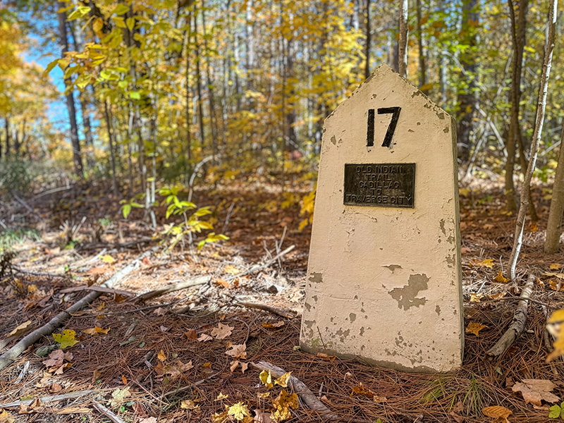
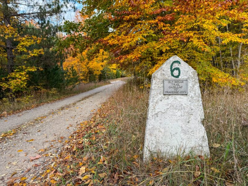
“A significant portion of a trail is (sometimes) a dotted red line,” he says. “They know where [the trail] started and where it ended, but they don’t know what was in the middle.” Ettawageshik has helped identify the trails’ beginning and end points; he was part of a group that finished marking the Old Indian Trail stretching from Cadillac to Traverse City.
Gratitude is due to Ettawageshik, as well as those who came before, for helping to preserve even the least of these trails and the history surrounding them. The paths that connected Michigan’s earliest communities to each other, as well as the resources needed for survival, still link people and trade routes today.
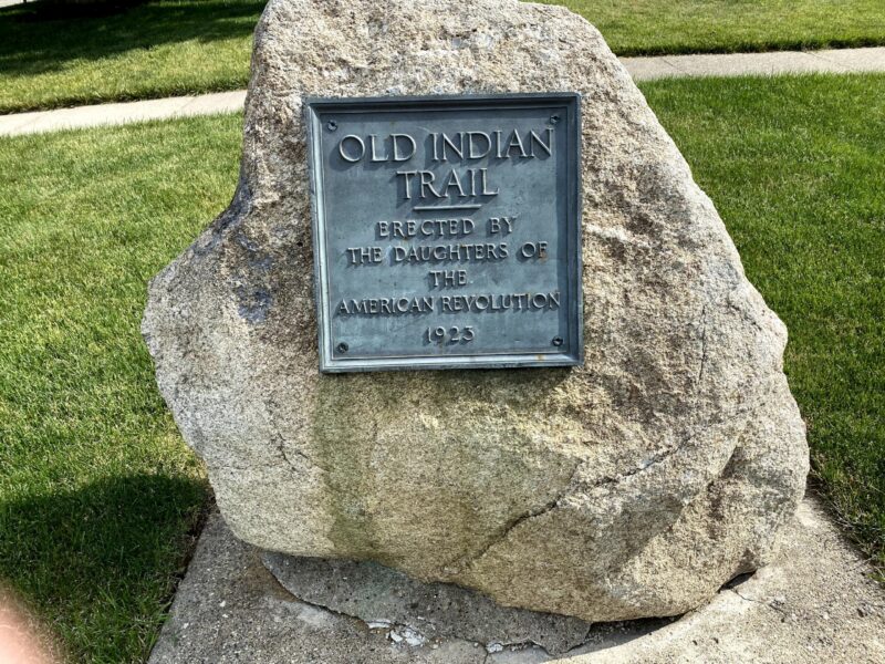
Driving down Woodward Avenue, knowing it was once part of a trail created by indigenous tribes, ties today’s Detroiters to history. Nature lovers, hiking enthusiasts, history lovers, or families looking for a unique travel experience can set their feet — or tires — where moccasin-clad feet once walked. Old Indian Trail near Sleeping Bear Dunes is a favorite, with visitors trekking its hiking loops. Technically, travelers may — and commonly do — walk or drive along sections of other trails. Driving on U.S. 12 or much of I-94 means traversing ancient indigenous trails — each a place of distinction.
U.S. 12 was officially dedicated as U.S. 12 Heritage Trail in 2004, an honor that recognizes the Native American trail’s significant place in the region’s natural and cultural history. I-94, which follows much of St. Joseph Trail, underwent government improvements beginning around 1825, when Michigan was still a territory, and became known as “Old Territorial Road.”
Woodward Avenue, too, has its own impressive Native American trail story.
“The reason it’s called ‘Woodward’ is because Judge Woodward was one of three territorial judges [who] came to Michigan in 1807,” Pielack says. “When he and the two others arrived, there had been a major fire, and it burned Detroit to the ground. Judge Woodward was all about redesigning Detroit so it was radiating out. He laid out a plan so when you look at an aerial of Detroit, you’ll see spokes — streets — that go out from the center. The Saginaw Trail was the one that went north and west, and he named it Woodward Avenue.”
Today, homeowners, landowners, municipalities, or corporations own much of the land that the early trails cover. Even so, some are open to the public, especially where the trails cross national and state parks. One site Ettawageshik recommends for its historical importance is for the courageous only, he says.
“There’s one place I know of you can actually drive a car — if you’re brave and know how to drive a two-track,” he says. “It’s south of Buckley [which is south of the Grand Traverse county line]. It’s the kind of thing where the grass is 3 feet tall. On top of the bluff, there’s a clearing in the woods where an old village was.” Ettawageshik cautions those inexperienced at driving two-tracks, noting that a call for a tow truck will likely be in their future. Remnants of the early village remain, such as holes used for cold food storage (not for fires, which Ettawageshik says is a common misunderstanding).
For an easier way to experience Native American trails throughout the state, go online, call the Chamber of Commerce in regions of interest, or contact national or state parks to learn where to find the trails in public areas that permit hiking or camping.
History enthusiasts may want to explore the ancient trail from Mesick to Buckley, where U.S. Forest Service employees discovered artifacts and burial mounds. Worn stone markers and even wagon wheel tracks from the bygone days of stagecoaches remain along this nearly lost trail. U.S. Forest Service resources report that a silver cross, thought to have belonged to a Jesuit priest, was found at the Buckley trail, as were a sword and metal fragments thought to have belonged to French explorer René-Robert Cavelier, Sieur de La Salle, who was recorded as having visited St. Joseph.
For those interested in experiencing Michigan’s outdoor beauty or feeling ensconced in some of its oldest history, the state’s Native American trails have much to offer.
This story originally appeared in the October 2026 issue of Hour Detroit magazine. To read more, pick up a copy of Hour Detroit at a local retail outlet. Click here to get our digital edition.
|
|
|
|
|
|