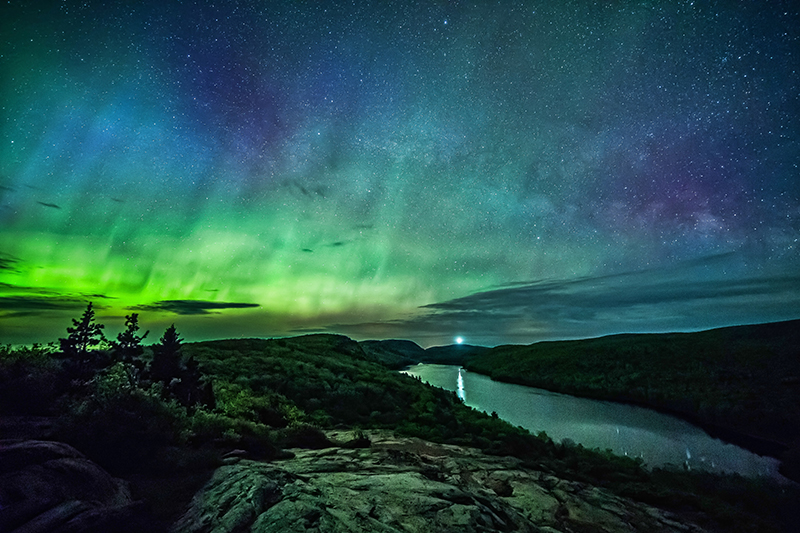
Life in a sprawling metropolitan area like metro Detroit can sometimes feel removed from nature. But despite the past few hundred years of human development, our state remains home to more than 8 million acres of public land ready to be explored — from two peninsulas and ancient formations dating back 3.5 billion years to five National Park Service sites, 103 state parks, and recreation areas spanning more than 360,000 acres.
And while there’s plenty of human ingenuity to be found in our state, sometimes the natural world has a way of taking our breath away. Here are a few places in Michigan that do just that. How many have you visited?
1. Arch Rock
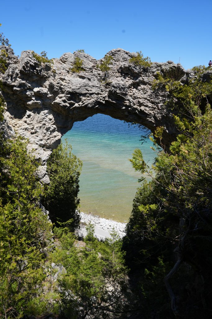
Location: Mackinac Island
Geology: This arch is made of limestone formed naturally underwater about 4,000 years ago. (In those days, much of Mackinac Island was submerged under the prehistoric Nipissing Great Lakes.)
By the numbers: The 50-foot arch towers 140 feet above Lake Huron.
Distance from the island ferry terminal: 1 mile
Where to view it: Close-up via a staircase and from below along Lake Shore Drive.
2. The Porcupine Mountains
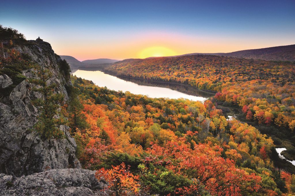
Location: Porcupine Mountains Wilderness State Park in Ontonagon
Behind the name: Porcupine Mountains is the English translation of the Ojibwe name Kag-wadjiw.
Claim to fame: Travel Lens ranked the park “the most beautiful state park in the nation.”
Nickname: The Porkies
By the numbers: Michigan’s largest state park — at 59,000 acres — has 90 miles of trails and 90 waterfalls.
Lake of the Clouds: One of the park’s most popular attractions, this 133-acre lake is tucked between two ridges in the mountain range. Visitors can hike to it or view it from an overlook with parking available nearby.
Summit Peak: This 50-foot wooden observation tower is located at the park’s highest point almost 2,000 feet above sea level, with views of the forests and Lake Huron. Weather-permitting, visitors can see all the way to Isle Royale and the Apostle Islands.
Visiting the park: A Recreation Passport is required for entry.
3. The Black Rocks
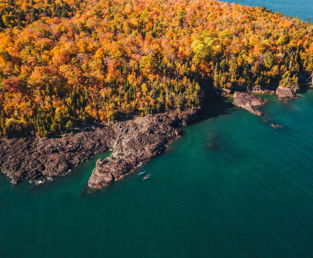
Location: Presque Isle Park in Marquette
Geology: The rocks are made from volcanic basalt formed by magma more than 1.7 billion years ago.
As seen in: The Adult Swim TV show Joe Pera Talks with You (Season 1, Episode 1)
Anishinaabe significance: For as long as 7,000 years, Indigenous people inhabited Presque Isle before European settlers arrived. Artist Sherri Loonsfoot Aldred painted the park’s sign, depicting what Presque Isle would have looked like during those times. Additionally, the park is home to the gravesite of Charlie Kawbawgam, the last chieftain of the local Ojibwe tribe, and his wife, Charlotte.
How to view it: Park entry is free, as is on-site parking in designated areas. The Black Rocks Beach is located on the north end of the park. A 2-mile road loops around the peninsula.
4. Kitch-Iti-Kipi of “Big Spring”

Location: Palms Book State Park in Manistique
Claim to fame: Michigan’s largest freshwater spring
Nickname: Mirror of Heaven
By the numbers: At 200 feet wide and 40 feet deep, the spring produces 10,000 gallons of water per minute, and the water is always 45 degrees.
Underwater beauty: The water is crystal clear, and the bottom is emerald green. The spring is the year-round home of many fish — mostly lake trout, brown trout, and brook trout.
How it became an attraction: Drawn to the spring, local businessman John Ira Bellaire arranged for the landowners, Palms Book Land Company of Detroit, to sell the 90-acre former logging site surrounding Big Spring to the State of Michigan for $10.
The legend: According to the Schoolcraft County Historical Society, Bellaire invented stories about the spring that he attributed to Indigenous people “for the sole purpose of luring tourists to the area.” In 2020, author Carole Lynn Hare published The Legend of Kitch-iti-Kipi, billed as the authentic story passed down by members of the Sault Ste. Marie Chippewa Indian band.
How to view it: The park is located along the northern terminus of M-149. A Recreation Passport is required for entry. A self-propelled observation raft is open from 8 a.m. to dusk.
5. Sleeping Bear Dunes

Location: Sleeping Bear Dunes National Lakeshore, Empire and Glen Arbor
Claim to fame: The largest freshwater dune system in the world
Behind the name: The dunes’ name comes from a story passed down in the Anishinaabe oral tradition. Also, one of the dunes used to resemble a sleeping bear due to its shape and the vegetation on top.
Trails to Lake Michigan: Make sure to do your homework. There are easy to strenuous trails, with some providing an easy walk to the lake and others warning of a steep drop.
Day visitor access: An entrance pass is required, starting at $15 per vehicle. Visit nps.gov/slbe/planyourvisit/trails.
6. Sugarloaf Mountain
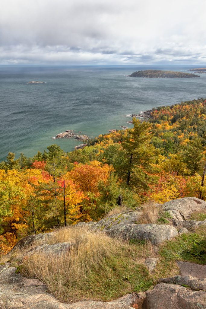
Location: Find a short trail to the top with three observation platforms 6 miles north of downtown Marquette along County Road 550.
By the numbers: The summit is 1,000 feet above sea level.
Views: Lake Superior, downtown Marquette, Presque Isle Park, and Little Presque Isle
Behind the name: According to The Armchair Mountaineer, there are more than 450 mountains around the world named Sugarloaf Mountain. Let’s get more creative, folks!
7. Tahquamenon Falls

Location: Tahquamenon Falls State Park in Paradise
Claim to fame: Michigan’s largest waterfalls (The Upper Falls is one of the largest east of the Mississippi River.)
By the numbers: The Upper Falls are 200 feet wide, have a 50-foot drop, and flow at up to 50,000 gallons of water per second.
Nickname: Root Beer Falls. Its amber color comes from the nearby cedar swamps that spill into the Tahquamenon River.
As mentioned in: “Tahquamenon Falls” (2003 song) by Sufjan Stevens; “The Song of Hiawatha” (1855 poem) by Henry Wadsworth Longfellow
How to view it: The park requires a Recreation Passport for entry. The Upper and Lower Falls each have a designated parking lot. The falls are connected by a 5.1-mile walking trail; shuttles between the two are available seasonally (fees apply).
8. Pictured Rocks

Location: Pictured Rocks National Lakeshore in Munising
Claim to fame: It is the first area designated as a National Lakeshore by the U.S. government (1966).
By the numbers: For 15 miles, the series of sandstone cliffs rise between 50 and 200 feet above Lake Superior.
Notable formations: Miners Castle, Chapel Rock, Lover’s Leap, Grand Portal Point
Notable waterfalls: Munising Falls, Miners Falls, Elliot Falls, Bridalveil Falls, Chapel Falls, Spray Falls, Mosquito Falls, Sable Falls
As seen in: Kid Rock’s music video for “Born Free”
How to see the rocks: Via hiking trails, boat cruises, and kayak tours
9. Horseshoe Harbor

Location: At the northern edge of the Keweenaw Peninsula on Lake Superior, a few miles east of Copper Harbor
Geology: Some of the beach’s unique reddish-brown sedimentary rocks have been around for as long as 1.085 to 1.106 billion years.
Preserving nature: The Nature Conservancy owns and maintains the beach as part of the 1,261-acre Mary Macdonald Preserve. Its unique ecosystem includes 11 species classified as rare or threatened.
Visiting the beach: A trailhead with parking is located at the end of Horseshoe Harbor Road. From there, it’s a 0.6-mile walk to the harbor through a wooded trail.
10. The Limestone Cliffs of Big Bay De Noc
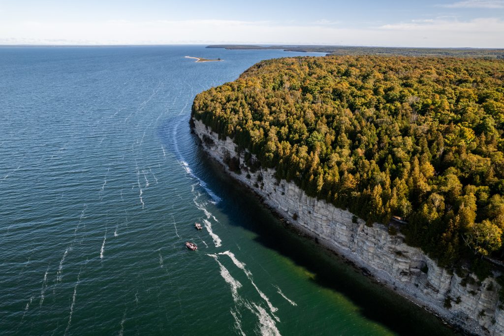
Location: Fayette Historic State Park in Garden
Botany: These cliffs are home to Michigan’s oldest living trees. White cedars protrude from the cracks and crevices, some of which are more than 1,000 years old.
By the numbers: 90 feet high
How to see them: A Recreation Passport is required to enter the park. View the cliffs from Snail Shell Harbor or the Fayette Historic Townsite — preserved buildings from a late-19th-century iron smelting town on the shore of Big Bay de Noc — or hike on 5 miles of trails.
Ancient history: Closed to the public, Spider Cave is an archaeological site along the shoreline on a formation called Burnt Bluff, located south of the state park’s main visitor area. Inside are Michigan’s only known prehistoric rock drawings. Archaeologists believe they were made sometime between 300 BC and 800 AD.
11. Turnip Rock

Location: On the Lake Huron coast near Port Austin
Geology: A unique stack formation shaped by thousands of years of erosion, with 20-foot trees growing on top
As seen in: The 2014 horror film Jinn
How to view it: The public can only view the formation by kayak or boat tours — the surrounding shoreline is all private property. The kayak ride from Port Austin is no easy feat: it’s about a 7-mile round trip. Check weather forecasts to ensure safe conditions. Kayak rentals and boat tours are available in Port Austin.
This story originally appeared in the July 2026 issue of Hour Detroit magazine. To read more, pick up a copy of Hour Detroit at a local retail outlet. Click here to get our digital edition.
|
|
|
|
|
|